Integrated Land and Water Information System (ILWIS) is a remote sensing and GIS software which integrates image, vector and thematic data in one unique and powerful package on the desktop.
ILWIS delivers a wide range of features including import/export, digitizing, editing, analysis and display of data, as well as production of quality maps.
ILWIS software is renowned for its functionality, user-friendliness and has established a wide user community over the years of its development. Even after its last commercial release in 2005, its user community has remained active, both within and outside ITC.
Features:
* Hydrologic Flow Operations
Parallel drainage correction over flat surface, cut terrain, Flow Length to Outlet, Flow Path Longitudinal Profile
* Spatial Multiple Criteria Evaluation (SMCE)
Contour maps, view standardized version of a criterion
* Projections
Hungarian projection, Mercator Scaled projection,
* Classify operation
Spectral angle classifier
* Import/Export
Export .PRJ file
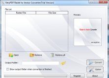
Raster to Vector Converter is used to convert raster files to vector files.


Comments (2)